Country shapes: world quiz

Islands, peninsulas and some of the strangest borders on the planet. Name these 20 countries from their silhouettes alone, each drawn to its true shape, then pass the quiz on to friends and family.

A free quiz from Megan Moran, author of The Mighty Geography Quiz Book.

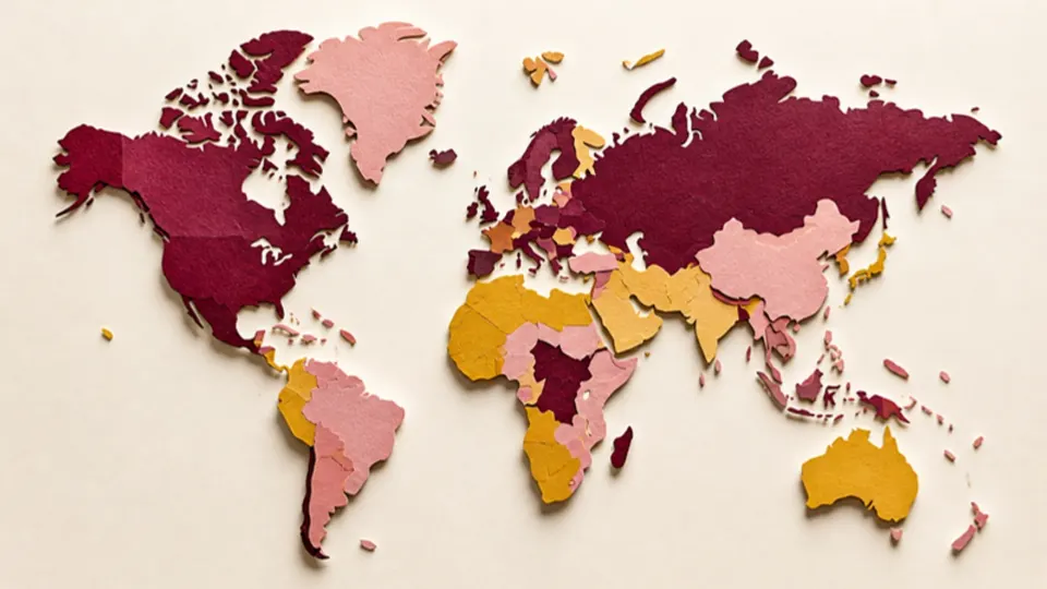
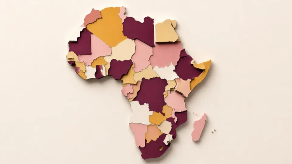
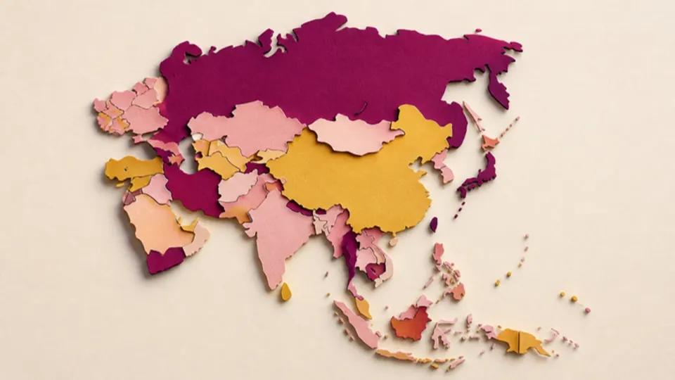
Paper-cut illustration of a world map made of separate cut-out continents
Pick an answer to start20 to go
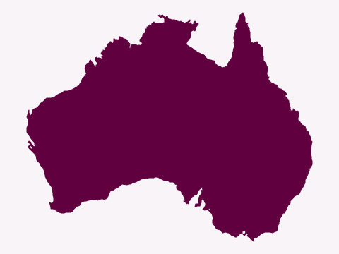
  1. Silhouette of a large landmass with a gulf in the north and a peninsula pointing up in the north-east
    Natural Earth (map data) · Public domain

    Question 1 of 20Country shapes: worldEasy

    Which country has this shape?

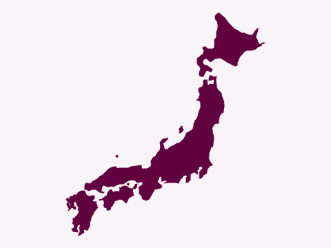
  2. Silhouette of a curved chain of large islands running from north-east to south-west
    Natural Earth (map data) · Public domain

    Question 2 of 20Country shapes: worldEasy
    Which country has this shape?

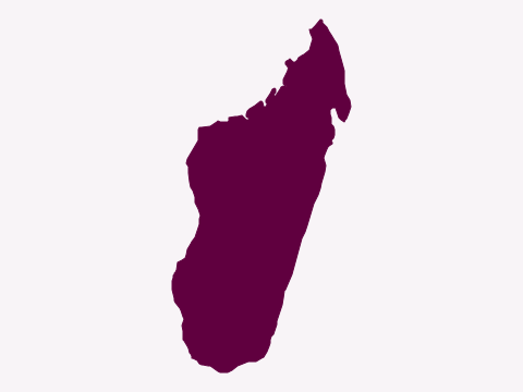
  3. Silhouette of a long island, wider at the bottom, tilted slightly to the right
    Natural Earth (map data) · Public domain

    Question 3 of 20Country shapes: worldMedium
    Which country has this shape?

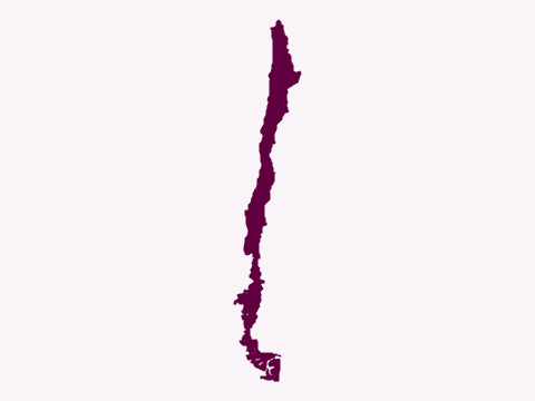
  4. Silhouette of an extremely long, thin country running north to south
    Natural Earth (map data) · Public domain

    Question 4 of 20Country shapes: worldEasy
    Which country has this shape?

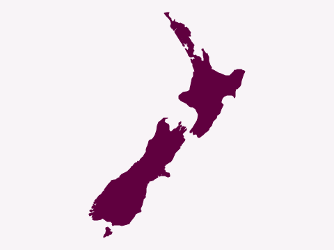
  5. Silhouette of two long main islands running from north-east to south-west
    Natural Earth (map data) · Public domain

    Question 5 of 20Country shapes: worldMedium
    Which country has this shape?

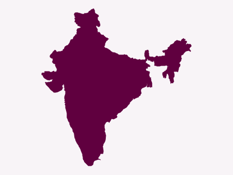
  6. Silhouette of a country that narrows to a point in the south, with a north-eastern section joined on by a narrow strip of land
    Natural Earth (map data) · Public domain

    Question 6 of 20Country shapes: worldEasy
    Which country has this shape?

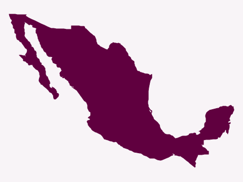
  7. Silhouette of a country that curves down to the south-east, with a long, thin peninsula in the west
    Natural Earth (map data) · Public domain

    Question 7 of 20Country shapes: worldMedium
    Which country has this shape?

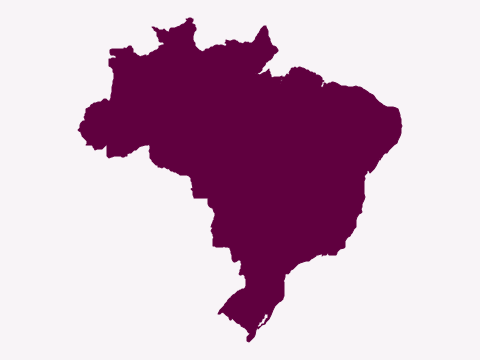
  8. Silhouette of a very large country with a long coastline bulging to the east
    Natural Earth (map data) · Public domain

    Question 8 of 20Country shapes: worldEasy
    Which country has this shape?

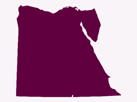
  9. Silhouette of an almost square country with a triangular peninsula in the north-east
    Natural Earth (map data) · Public domain

    Question 9 of 20Country shapes: worldMedium
    Which country has this shape?

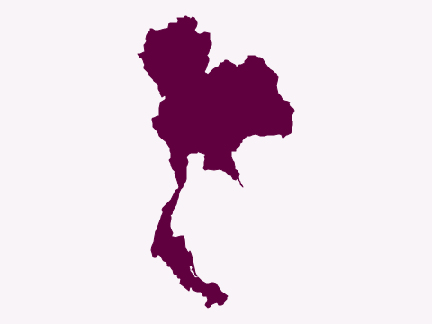
  10. Silhouette of a country with a rounded northern part and a long, thin strip running south
    Natural Earth (map data) · Public domain

    Question 10 of 20Country shapes: worldHard
    Which country has this shape?

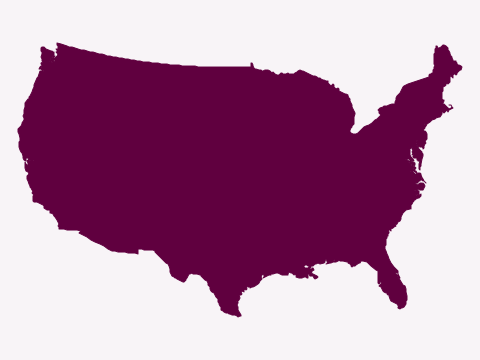
  11. Silhouette of a wide country with a straight northern border and a peninsula in the south-east
    Natural Earth (map data) · Public domain

    Question 11 of 20Country shapes: worldEasy
    Which country has this shape?

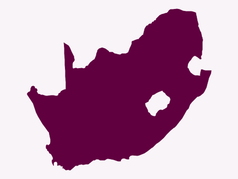
  12. Silhouette of a country at the tip of a continent, with a hole in its eastern half
    Natural Earth (map data) · Public domain

    Question 12 of 20Country shapes: worldMedium
    Which country has this shape?

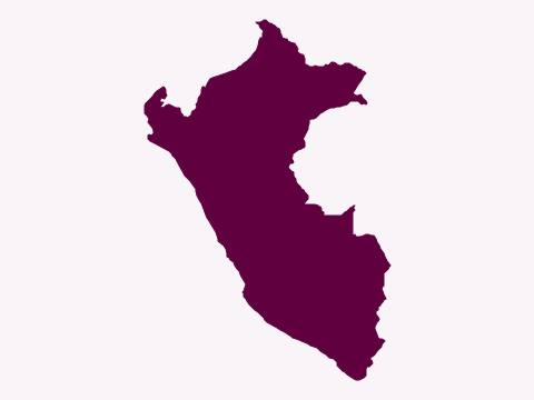
  13. Silhouette of a country with a long coastline on its south-west side and a bulge to the north-east
    Natural Earth (map data) · Public domain

    Question 13 of 20Country shapes: worldHard
    Which country has this shape?

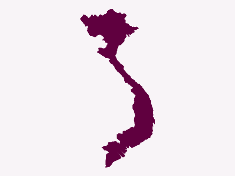
  14. Silhouette of a long, S-shaped country that is very narrow in the middle
    Natural Earth (map data) · Public domain

    Question 14 of 20Country shapes: worldMedium
    Which country has this shape?

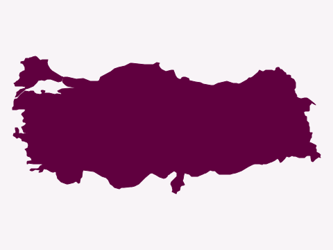
  15. Silhouette of a wide, rectangular country with a small piece separated in the far north-west
    Natural Earth (map data) · Public domain

    Question 15 of 20Country shapes: worldMedium
    Which country has this shape?

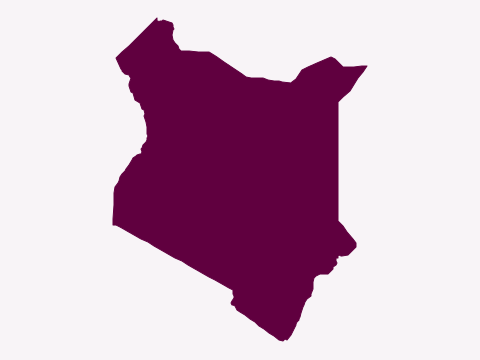
  16. Silhouette of a country with mostly straight borders and a short coastline in the south-east
    Natural Earth (map data) · Public domain

    Question 16 of 20Country shapes: worldHard
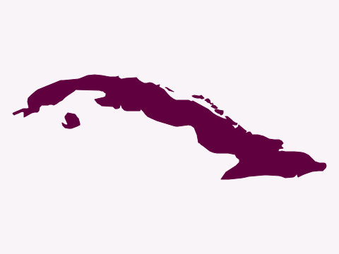
    Which country has this shape?

  17. Silhouette of a long, narrow island curving from west to east
    Natural Earth (map data) · Public domain

    Question 17 of 20Country shapes: worldMedium
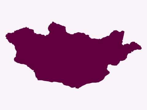
    Which country has this shape?

  18. Silhouette of a wide, landlocked country, roughly twice as wide as it is tall
    Natural Earth (map data) · Public domain

    Question 18 of 20Country shapes: worldHard
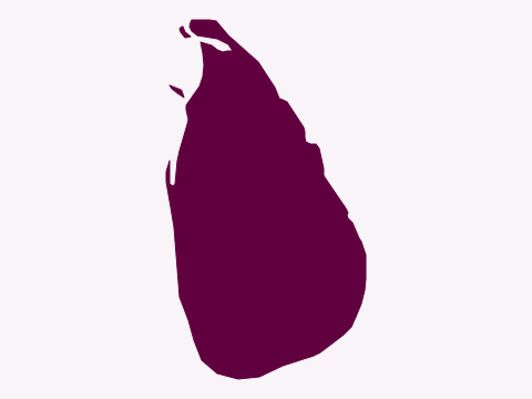
    Which country has this shape?

  19. Silhouette of a pear-shaped island with a thin spur at the top
    Natural Earth (map data) · Public domain

    Question 19 of 20Country shapes: worldMedium
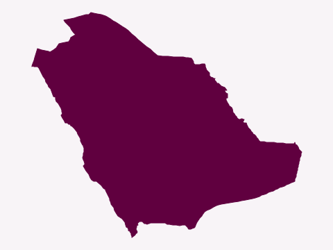
    Which country has this shape?

  20. Silhouette of a large country covering most of a peninsula, with coasts on two sides
    Natural Earth (map data) · Public domain

    Question 20 of 20Country shapes: worldHard

    Which country has this shape?

Answer all 20 to see your score.

Want more? The Mighty Geography Quiz Book has over 1,000 questions like these, ready for your next quiz night.
Show all the answers, with the facts behind them
  1. Which country has this shape? AustraliaAustralia's island state, Tasmania, isn't shown; it lies about 240 km south of the mainland across the Bass Strait.
  2. Which country has this shape? JapanJapan's four main islands are Honshu, Hokkaido, Kyushu and Shikoku, alongside thousands of smaller ones.
  3. Which country has this shape? MadagascarMadagascar is the world's fourth-largest island.
  4. Which country has this shape? ChileChile is more than 4,000 km long but on average less than 200 km wide.
  5. Which country has this shape? New ZealandNew Zealand's two main islands are simply called the North Island and the South Island.
  6. Which country has this shape? IndiaIndia's southern tip, Kanyakumari, is where the Arabian Sea, the Bay of Bengal and the Indian Ocean meet.
  7. Which country has this shape? MexicoThe Baja California peninsula runs for more than 1,200 km down Mexico's Pacific coast.
  8. Which country has this shape? BrazilBrazil is the world's fifth-largest country and borders every South American country except Chile and Ecuador.
  9. Which country has this shape? EgyptMuch of Egypt's border is drawn in straight lines, and nearly all Egyptians live along the Nile and its delta.
  10. Which country has this shape? ThailandThailand's shape is often compared to an elephant's head, with the Malay Peninsula as its trunk.
  11. Which country has this shape? United StatesThis is the contiguous United States: Alaska and Hawaii are left off, as on many maps.
  12. Which country has this shape? South AfricaThe hole is Lesotho, a separate country completely surrounded by South Africa.
  13. Which country has this shape? PeruPeru takes in part of the Amazon rainforest, the Andes and a long desert coast on the Pacific.
  14. Which country has this shape? VietnamVietnam's S shape stretches about 1,650 km from north to south.
  15. Which country has this shape? TurkeyTurkey spans two continents; the small part west of the Bosphorus lies in Europe.
  16. Which country has this shape? KenyaThe Equator runs through Kenya, which has a coastline on the Indian Ocean.
  17. Which country has this shape? CubaCuba is the largest island in the Caribbean.
  18. Which country has this shape? MongoliaMongolia is the most sparsely populated sovereign country in the world.
  19. Which country has this shape? Sri LankaSri Lanka's shape has earned it the nickname 'the teardrop of India'.
  20. Which country has this shape? Saudi ArabiaSaudi Arabia covers most of the Arabian Peninsula and has no permanent rivers.